Is The Great Barrier Reef Dead? What The 2026 Evidence Actually Says
The Great Barrier Reef is not dead, but it is not untouched either. The official monitoring record for 2026 tells a more complicated story, and it is one every snorkeller leaving Cairns should understand before choosing a boat.
Short answer
No. AIMS monitoring shows Northern Great Barrier Reef hard coral cover at 35.1% in 2026, up from 30.0% and above the 27.0% long-term average, after a regional bleaching event and a category 5 cyclone earlier in the year. The reef is damaged, changing and still very much alive.
Is The Great Barrier Reef Dead?
No, and the people who measure it for a living do not say it is. The Australian Institute of Marine Science surveyed 121 reefs for its 2025/26 condition report and found hard coral cover in the Northern Great Barrier Reef at 35.1%, up from 30.0% the year before and above the 27.0% long-term average. That is a reef recovering from a hard summer, not a reef that has died. That recovery is good news for anyone hoping to get in the water, and our guide to swimming from Green Island covers the flagged area, stinger season, and what the latest reef science means for visitors.
The question keeps arriving because the headline has been predicted for two decades. Coral bleaching, cyclones, crown-of-thorns starfish and flood plumes are all real, documented pressures, and the reef that leaves Cairns every morning on a fast catamaran is not the same reef earlier generations snorkelled. But "not what it was" and "dead" are very different claims, and the second one is not supported by the monitoring record.
This guide walks through what the official data for 2026 actually says, where it comes from, and how a day visitor should read it. It draws on the AIMS Long-Term Monitoring Program summary released in August 2026, the GBRMPA end-of-summer snapshot and the reef health updates that followed. Where the data is regional rather than Green Island specific, we say so plainly, because no official Green Island snorkel-reef condition report exists, and a page that invents one is lying to you.
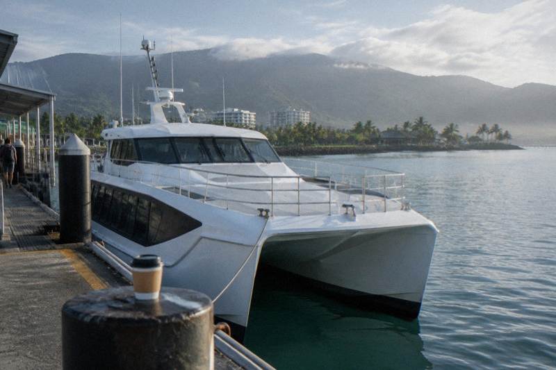
The practical payoff matters too. The Great Adventures catamaran, the Big Cat full day cruise and the Moore Reef pontoon combo all run onto this reef system daily, and reef condition genuinely changes what a first-time snorkeller should expect from each of them. More on that below.
What Did The 2026 Coral Cover Survey Find?
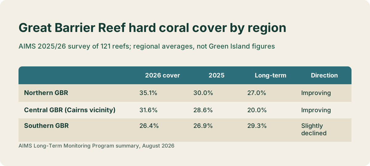
AIMS surveyed 121 reefs between August 2025 and June 2026 and reported Northern Great Barrier Reef hard coral cover at 35.1%, Central at 31.6% and Southern at 26.4%. The Northern and Central regions both improved on 2025 and sit above their long-term averages. Of the surveyed reefs, 28% gained coral, 56% showed no net change and 16% declined.
Those numbers deserve context, because "coral cover" gets thrown around without explanation. AIMS divers measure the share of reef surface covered by hard coral along fixed transects, year after year, on the same reefs. Cover above 30% is considered high in the institute's reporting bands. The Northern region, which runs from Cape York to Cooktown, jumped 16.7% relative to its 2025 reading, and the Central region, which covers the Cairns and Green Island vicinity, rose 10.2% to 31.6% against a 20.0% long-term average.
| Region | 2026 hard coral cover | 2025 | Long-term average | Direction |
|---|---|---|---|---|
| Northern GBR | 35.1% | 30.0% | 27.0% | Improving |
| Central GBR (Cairns vicinity) | 31.6% | 28.6% | 20.0% | Improving |
| Southern GBR | 26.4% | 26.9% | 29.3% | Slightly declined |
Two cautions attach to that table. First, regional averages hide variation between individual reefs: in the same survey, 42 reefs sat at 30 to 50% cover, 12 above 50%, and 3 below 10%. Second, and this is the point honest writing demands, none of these figures is a Green Island measurement. They describe thousands of kilometres of reef. What they establish is the direction of the system your tour operates within, and in 2026 that direction, in the north and centre, was upward.
The recovery pattern follows a known script. The 2024 mass bleaching knocked coral cover back across wide areas, and the late-summer monsoon of 2026 limited heat stress enough for fast-growing corals to regain ground. AIMS itself frames the result as early recovery, not a clean bill of health.
If reading that has convinced you to go see it, these are the three listings most first-time visitors compare.
The Great Adventures catamaran, from A$112 per person with a 4.4 rating across 1,933 reviews, is the most reviewed way to reach the island. The pontoon combo and the Big Cat full day each suit different budgets and appetites, and we break all three down later in this guide.
What Actually Happened In Summer 2026?
GBRMPA's end-of-summer snapshot records a regional coral bleaching event in the Northern region that became apparent in March 2026 after prolonged heat exposure, plus Severe Tropical Cyclone Narelle, category 5, crossing the Far Northern reef in the same month. AIMS also logged minor coral losses from Ex-Tropical Cyclone Koji, category 1, in the Central region in January.
That is a genuinely bad summer by any standard, and pretending otherwise would be as dishonest as declaring the reef dead. Bleaching occurs when heat-stressed corals expel the algae living in their tissue. It does not always kill the coral: if the water cools in time, corals can recover, and the AIMS survey that followed found low levels of bleaching on the reefs it measured.
Cyclone Narelle deserves its own sentence. GBRMPA reports wave damage to reefs between Cairns and Lizard Island, and AIMS noted that two offshore reefs near Lizard Island declined by up to 5% reef-wide despite lying well away from the track. The full assessment of Narelle's damage waits on the 2027 survey season, so anyone quoting a firm cyclone damage figure today is ahead of the data.
| 2026 event | Timing | Where | Official word |
|---|---|---|---|
| Ex-Tropical Cyclone Koji, category 1 | January 2026 | Central GBR | Minor coral losses on several reefs |
| Regional bleaching event | Apparent March 2026 | Northern region | After prolonged heat exposure |
| Severe Tropical Cyclone Narelle, category 5 | March 2026 | Far Northern region | Wave damage between Cairns and Lizard Island |
For a Green Island visitor, the honest reading is this: the system took three separate hits in one summer, and the coral cover numbers measured afterwards still came in above the long-term average in both the Northern and Central regions. Both things are true. A reef that bleaches and recovers is a living reef under pressure, which is exactly what the monitoring bodies say it is. The GBRMPA snapshot page carries the full statement for anyone who wants the primary wording.
Planning around it is simpler than the science. Free cancellation applies to every Green Island tour compared here, so booking ahead and rebooking after a storm costs nothing.
How Warm Is The Water Right Now?
GBRMPA's reef health update reported sea surface temperatures close to average through August 2026, with the Northern region running 0.1 to 0.3 degrees above average, and forecasts of temperatures remaining near average into spring. The NOAA Coral Reef Watch stations covering the reef regions sat at No Stress in early October 2026.
That matters because heat is the driver behind bleaching, and the current readings are about as calm as they get. The same update noted crown-of-thorns starfish control teams surveyed or culled on 47 reefs as of 30 August 2026, with active culling on 28 of them, an ongoing management programme rather than an emergency response.
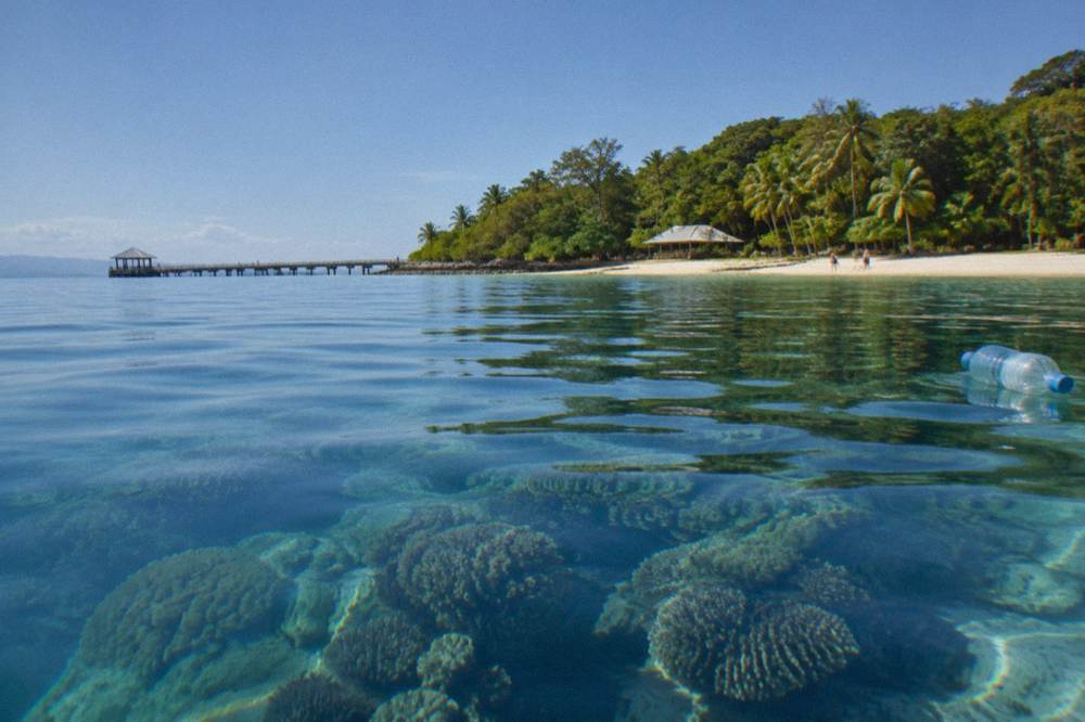
What no official source will give you, and what this site refuses to invent, is a water temperature or underwater visibility figure for Green Island by month. The AIMS logger data for the island sits behind a data portal, and no published monthly table exists. Any travel page quoting Green Island water temperatures to the degree is guessing at your expense. Regional anomaly statements like the ones above are the only citable temperature facts, and they are the only ones printed here.
For planning purposes, air temperature is better documented. Bureau of Meteorology averages for Cairns run from about 31 degrees max in January down to about 26 in July, with monthly rainfall dropping from summer readings of 404.8 to 437.5 millimetres down to under 50 millimetres across the June to August window. Dry season trips mean calmer weather and clearer discussion of the water, whatever the coral below is doing. Our guide to Green Island weather and the best time to visit carries the full monthly picture.
What Does Coral Cover Mean For A Snorkeller?
Hard coral cover describes how much reef surface is living coral, not how pretty it looks from the water. A reef at 31.6% cover in the Cairns region can still show patchy, storm-flattened areas beside vigorous new growth, and snorkellers on the same day can honestly report opposite impressions depending on which bommie they floated over.
This is the gap most reef-health writing fails to bridge. Coral cover is an ecological indicator measured along transects by scientists. What a snorkeller experiences is colour, fish abundance, water clarity and structure, and those ride on cover without matching it one to one. A recovery-phase reef is often full of branching young corals and clouds of juvenile fish, which many visitors enjoy more than a mature plateau of massive corals. The wider set of guides lives on Green Island Great Barrier Reef Tours.
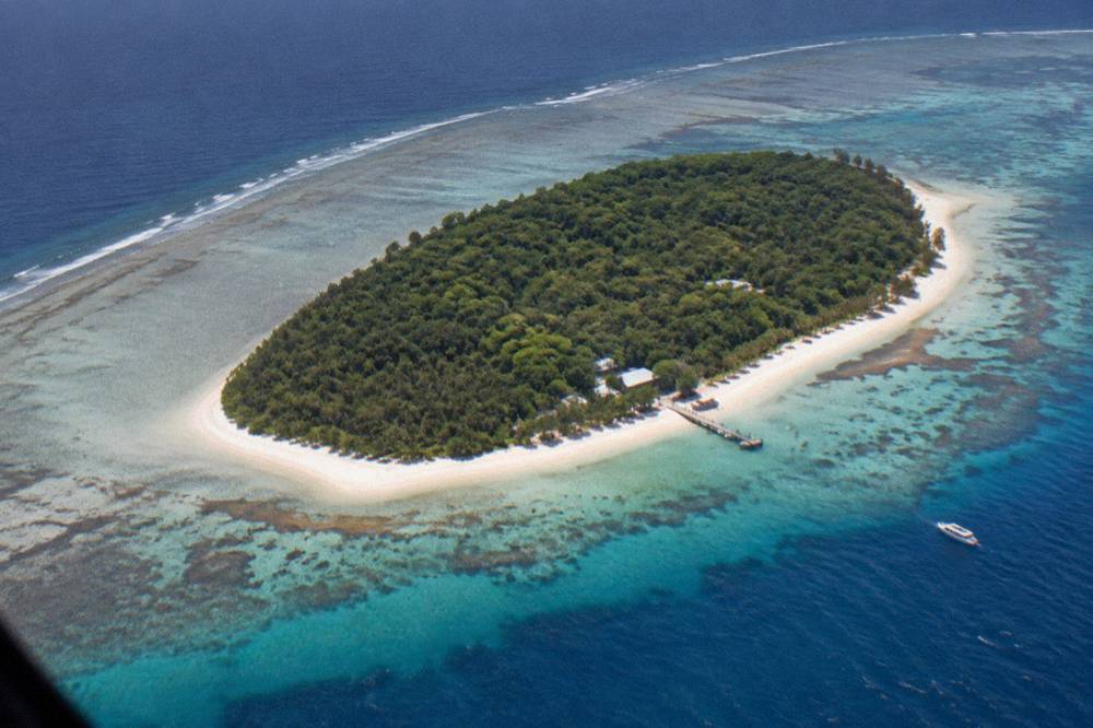
Around Green Island specifically, Queensland Parks describes coral reef and seagrass beds surrounding the island, with turtles living and feeding in the seagrass and coral bommies holding tropical fish. That is habitat description, not a condition rating, and it is the most any official source claims for the island. The surrounding waters fall inside no-take marine park zones where fishing and motorised water sports are prohibited, which is itself a health measure: the fish populations a snorkeller meets there are protected ones.
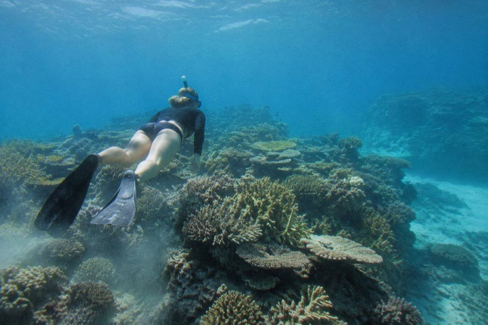
The practical takeaway is to match expectations to boat type. A beach-entry snorkel off Green Island shows you an inshore cay reef, sheltered, shallow and busy with small marine life. The Moore Reef pontoon combo, from A$312 per person with a 4.6 rating from 98 reviews, puts you on an outer reef activity platform for three hours with snorkel gear, lycra suits and a marine biologist presentation included. They are different reefs showing different things, and our longer comparison of Cairns snorkelling, island or outer reef works through the choice in detail.
The pontoon option is the one most worth considering if reef health is the reason you are travelling, because outer platform sites are where the coral structure is most dramatic.
Which Boats Go Out In These Conditions?
All of them, year round, weather permitting. The Great Adventures catamaran, the Big Cat fleet, the Ocean Free schooner and the fly-and-cruise package all run scheduled Green Island services regardless of reef condition headlines, with about 45 minutes of crossing time from Cairns. Reef health changes what you see under the surface, not whether the boats sail. That easy access is a big part of the story in why Cairns is famous as the gateway to the reef and the rainforest, which also covers why Green Island makes such a simple day trip from the city.
That sounds obvious, but the "dead reef" question often hides a practical worry: will the trip be a waste? The honest answer is that the reviews for these tours describe live, recent experiences. The Big Cat full day, from A$110 per person, carries a 4.5 rating from 1,727 reviews. The Ocean Free schooner day, which includes lunch and a complimentary glass of wine on the return sail, rates 4.9 from 682 reviews. The dive version of the same sailing day rates 4.8 from 413.
| Listing | Rating and reviews | From price | What it shows a snorkeller |
|---|---|---|---|
| Big Cat full day | 4.5 from 1,727 reviews | A$110 pp | Island cay reef, snorkel or glass-bottom boat |
| Great Adventures catamaran | 4.4 from 1,933 reviews | A$112 pp | Cay reef plus marine biologist reef talk |
| Ocean Free schooner sailing | 4.9 from 682 reviews | A$289 pp | Small-group sail to island and reef sites |
| Green Island and outer reef pontoon combo | 4.6 from 98 reviews | A$312 pp | Outer reef platform, three hours in the water |
| Green Island full day with diving | 4.9 from 10 reviews | A$250 pp | Cay reef with scuba equipment included |
One caveat on the last row: 4.9 from 10 reviews is a high rating from a small pool, not a verdict. Every figure in that table comes straight from the live booking pages, with nothing rounded or averaged.
The weather question matters more than the health question for a single day. Cyclone season runs officially from 1 November to 30 April, and marine stingers are of particular concern from November to June, with Queensland Parks warning they may be present in any month. Operators supply stinger suits where their listings state it, and our page on stinger season and stinger suits in Cairns covers suit policy listing by listing.
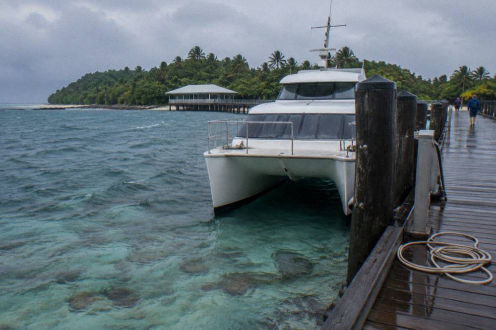
For the classic island day at the classic price, the Big Cat full day remains the entry point most visitors pick first.
Is The Reef Recovering Or Dying Overall?
The 2026 evidence says recovering from 2024 in the Northern and Central regions, with a Southern region that has slipped below its long-term average, while every region remains exposed to future heat events. AIMS records 56% of surveyed reefs with no net change and 28% gaining, against 16% declining, which is a system rebuilding unevenly rather than collapsing uniformly.
Recovery language needs its limits stated. Coral cover can rebound within a few years because fast-growing Acropora corals drive the numbers, and those same corals are the first to die in the next heatwave. Scientists describe this as a reef trading long-term resilience for short-term gains, and it is why an improving chart and an uncertain future coexist in the same AIMS report. Neither the optimist's headline nor the pessimist's is the whole truth.
| Pressure | 2026 status | Source framing |
|---|---|---|
| Heat stress and bleaching | Regional event March 2026, low levels observed in surveys | Recovery under way, cause ongoing |
| Cyclones | Koji (cat 1) and Narelle (cat 5) both crossed the reef | Wave damage recorded, full assessment in 2027 |
| Crown-of-thorns starfish | Detected on 27 surveyed reefs, no severe outbreaks | Fifth outbreak wave emerging in the north |
| Coral cover | 35.1% Northern, 31.6% Central | Above long-term averages in both |
The crown-of-thorns line is worth watching. AIMS reports the fifth wave of outbreaks emerging in the Northern Great Barrier Reef, with established outbreaks on two Northern reefs, and GBRMPA's control programme is actively culling, including on high-value Cairns-region reefs. Starfish outbreaks have historically stripped whole reef systems, so this is the pressure most likely to eat the current recovery if management slackens.
What does this mean for the water you will actually float in? Nothing measurable and everything directional. The regions that contain Green Island's reef are gaining coral, the current temperature anomalies are near zero, and the reef you meet in 2026 is being described by its own monitoring bodies as recovering, damaged and alive at once. If you want the primary documents, the AIMS condition summary and the GBRMPA reef health updates are both public.
How Should You Snorkel A Reef Under Pressure?
Follow the marine park rules that exist precisely because the reef is under pressure: no touching or standing on coral, no feeding or chasing wildlife, stay on marked tracks on the island, and snorkel between the red and yellow flags at Green Island. Drones are not permitted on the island, and the surrounding waters are no-take zones.
These are Queensland Parks rules for Green Island National Park, published in the official discovery guide, not suggestions. They protect a reef whose recovery the data has just described. A single fin kick can break decades of coral growth, and the seagrass beds where turtles feed are the habitat that makes the island's snorkelling distinctive in the first place.
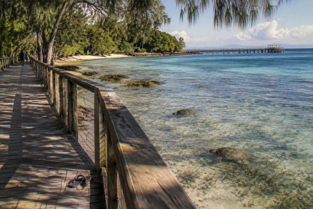
Wildlife expectations deserve the same honesty as coral statistics. Queensland tourism bodies and the resort describe green turtles as commonly sighted near the jetty and in the seagrass, and hawksbill turtles feed in the same meadows year-round. None of that promises you a turtle on your day, and no listing on this site guarantees a sighting of anything. A quiet day is possible, and the operators who say otherwise are selling harder than they should.
Choosing a smaller footprint changes the experience as well as the impact. The Ocean Free schooner takes a small group out for a full nine-hour sailing day with snorkel instruction, in-water crew assistance, a smorgasbord lunch and a marine naturalist's reef talk, all from A$289 per person. Sailing to the reef rather than motoring is a quieter way to arrive at a fragile place.
Before booking any of them, one planning note: every tour on this site charges from A$110 to A$429 per person, and the Environmental Management Charge, A$8.50 for a full-day passenger, is built into some fares and stated as absent from others. Our breakdown of the Green Island reef tax and what is included lists which is which.
Common Questions About Whether The Great Barrier Reef Is Dead
Is the Great Barrier Reef dead?
No. AIMS 2025/26 monitoring recorded Northern hard coral cover at 35.1%, up from 30.0%, and Central at 31.6%, both above long-term averages. The reef is under serious pressure but is measurably recovering in the regions nearest Cairns.
Did the March 2026 bleaching kill the reef?
GBRMPA recorded a regional bleaching event in the Northern region, apparent from March 2026 after prolonged heat. AIMS surveys afterwards found low bleaching levels and rising coral cover, meaning most heat-stressed corals recovered rather than died.
Is Green Island's reef healthy?
No official Green Island-specific condition report exists. The island sits inside the Central region, where hard coral cover rose to 31.6% in 2026, and Queensland Parks describes coral reef and seagrass habitat surrounding the island.
Is it still worth snorkelling the Great Barrier Reef?
Yes, with honest expectations. The review pools on verified listings, including a 4.5 from 1,727 reviews for the Big Cat full day and a 4.9 from 682 for the Ocean Free schooner, describe live, enjoyable reef experiences throughout 2026.
What is killing the Great Barrier Reef?
Heat stress from marine heatwaves, cyclones, crown-of-thorns starfish outbreaks and flood plumes are the four documented pressures in GBRMPA and AIMS reporting. All four appeared in the 2026 record, and the reef recovered ground anyway.
Where can I check reef health myself?
The AIMS Long-Term Monitoring Program publishes an annual condition summary and the GBRMPA website posts monthly reef health updates. Both are free, public and more current than any travel article, including this one.